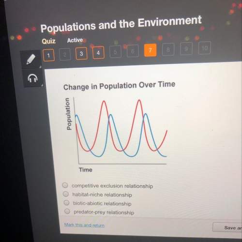
they both go up but then go back down. they both end lower than they started. lastly, they both are competitive/the second on.
explanation:
Another question on Biology
Biology, 22.06.2019 02:30
Why would satellite imagery be more useful than a map in some instances? check all that apply. provides landmarks such as buildings is an overhead view of earth’s features can be used when internet is not available provides small details of roads for digital maps provides various methods of transportation to a location
No commitments. Cancel anytime. All pricing is in US dollars (USD). The subscriptoin renews automaticaly until you cancel. For more information read our Terms of use & Privacy Policy