
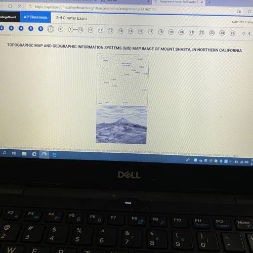
The images show a topographic map and a geographic Information systems (GIS) representation of Mount Shasta in California. Which of the following statements best explains why these
printed images are geometrically distorted representations of Earth's surface?
A
Some maps do not show the actual coloration of Earth's surface and vegetation
B
GIS can only display two dimensional layers
C
The planet's gravitational poles are not located at the poles of Eartly's axis
D
The three dimensions of Earth's surface are displayed on a two dimensional page
E
Printed maps alter the sense of place that people can have about a location

Answers: 2


Another question on Geography
Geography, 23.06.2019 02:00
The ratio of the measures of the three angles in a triangle is 14: 15: 11 find the measures of the angles
Answers: 2
Geography, 24.06.2019 03:00
How far is a geographic second? a.) around 100 feet b.) around 1,000 feet c.) around 5,000 feet d.) none of the above
Answers: 2
You know the right answer?
The images show a topographic map and a geographic Information systems (GIS) representation of Mount...
Questions

Mathematics, 06.08.2021 16:10


English, 06.08.2021 16:10

Mathematics, 06.08.2021 16:10
English, 06.08.2021 16:10

Mathematics, 06.08.2021 16:10
History, 06.08.2021 16:10


