Geography, 10.03.2021 01:00 pheonixhowls
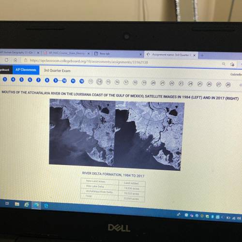
The satellite images show changes to a portion of the Louisiana coast between 1984 and 2017. The table shows the changes in land acreage. Which of the following best describes the changes
and a consequence of the changes?
A )The expansion of coastal cities, which results in increased acreage of urban land cover
B) A decrease in the acreage of coastal land,
which affects the prices of local property
c )An increase in the acreage of coastal land, which will be added to navigational charts for shipping
D )The rise of sea levels, which results in decreased land acreage available for homes and businesses
E )An increase in land acreage caused by the construction of polders for land reclamation


Answers: 3


Another question on Geography


Geography, 24.06.2019 01:00
Which of the following statements best describes east asia? a. east asia is known to be the crafle of civilizationb. east asia is one of the world's most populates placesc. east asia is one of the worlds riches placesd. east asia is located near the equator me asap huhu
Answers: 1

Geography, 24.06.2019 11:00
Major river of southeast asia flowing through laos thailand vietnam and cambodia
Answers: 1
You know the right answer?
The satellite images show changes to a portion of the Louisiana coast between 1984 and 2017. The tab...
Questions

Mathematics, 05.11.2020 16:30


Chemistry, 05.11.2020 16:30


Physics, 05.11.2020 16:30

French, 05.11.2020 16:30


Computers and Technology, 05.11.2020 16:30


English, 05.11.2020 16:30


Mathematics, 05.11.2020 16:30


