
Geography, 09.11.2019 03:31 anayajhughes0603
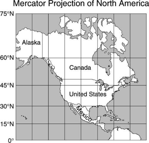
In this mercator map of north america, canada and alaska together appear larger than the united states and mexico together when in fact they are smaller. what causes this distortion?
f the map is a projection of a round world onto a flat surface.
g the latitude and longitude lines create an optical illusion.
h the northern regions are enlarged because the shallower
parts of the ocean are frozen.
j mountains get flattened on a map so that mountainous
areas look larger than they really are.

Answers: 2


Another question on Geography
Geography, 22.06.2019 21:30
What structure on the south african coast has a range of 63 km and releases flashes every 30 seconds?
Answers: 1
Geography, 23.06.2019 02:00
If the distance between two points on the ground is 10 miles and the distance between the same two points on a map is 4 inches, what is the map scale expressed as a ratio?
Answers: 1
You know the right answer?
In this mercator map of north america, canada and alaska together appear larger than the united stat...
Questions


Computers and Technology, 07.08.2019 05:10


Social Studies, 07.08.2019 05:10
Social Studies, 07.08.2019 05:10
Social Studies, 07.08.2019 05:10
Social Studies, 07.08.2019 05:10


