
Geography, 09.09.2021 23:40 carlybeavers50
HELP
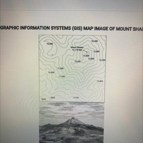
The images show a topographic map and a geographic information systems parentheses GIS parentheses representation of mount Shasta in California. Which of the following statements best explains why these printed images are geometrically distorted representations of earths surface?
A Some maps do not show the actual coloration of earths surface and vegetation
B GIS can only display two dimensional layers
C The planets gravitational poles are not located at the poles of earths axis
D three dimensions of earths surface are displayed on two dimensional page
E printed Maps alter the sense of place that people can have about a location

Answers: 3


Another question on Geography
Geography, 22.06.2019 12:50
5. how is transported soil different from residual soil? o a. it forms on unconsolidated materials. ob. it develops on bedrock. o c. it has been moved from another location. d. it transports other materials.
Answers: 3
Geography, 23.06.2019 09:30
From the standpoint of geography,a is an internal rendering of an individual's known world
Answers: 3
Geography, 23.06.2019 16:10
Migrant workers who fill employment needs in their host country often send remittances to their home countries
Answers: 2
You know the right answer?
HELP
The images show a topographic map and a geographic information systems parentheses GIS parent...
Questions

Mathematics, 10.07.2019 02:00


Biology, 10.07.2019 02:00
Mathematics, 10.07.2019 02:10
Mathematics, 10.07.2019 02:10

Social Studies, 10.07.2019 02:10
Mathematics, 10.07.2019 02:10

Spanish, 10.07.2019 02:10
Mathematics, 10.07.2019 02:10
Biology, 10.07.2019 02:10

English, 10.07.2019 02:10


